
- Home >
- Topics
Topics of No.13 (March, 2018)


Harnessing photos and laser measurements from UAVs instead of people on-site to prevent disasters
Saitama Prefecture has numerous locations in which legally required measures to prevent rockfalls have yet to be undertaken. In fiscal 2016, there were nine cases of rockfalls on prefectural roads, three of which caused motor accidents. In April 2017, a rock about 50 centimeters in diameter hit a light vehicle, which went off a cliff and killed the driver. Most of the roads under the jurisdiction of the Prefectural Land Development Office in Chichibu, Saitama Prefecture, are in mountainous areas, so it is not clear whether all required preventive measures are in place. Another issue is that it has been impossible to place construction orders in unchecked areas because of concerns about possible rockfalls. We therefore proposed using drones to conduct surveys with a view to preventing rockfalls on roads. To prepare, we conducted field surveys and assessed takeoff and landing sites, flight courses, and worker positioning. In the survey, the drones flew at altitudes above 50 meters at a speed of five meters per second. We will use the collected point cloud and other information to create topographical maps and formulate overall plans and engineering measures to prevent landslides.
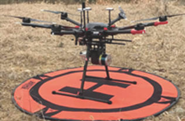
Survey drones incorporate GPS antennas, cameras, and laser equipment.
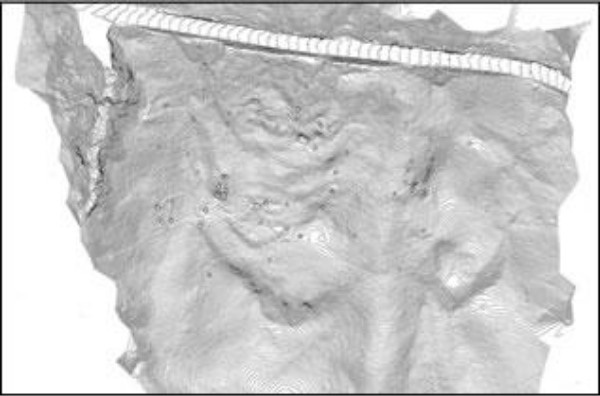
Analysis results for data collected by drones.
We created a hazard map that quantifies the scale of damage and evaluates priority of measures and policy organization
The Great East Japan Earthquake and the Kumamoto earthquake made roads virtually unusable for emergency traffic because of liquefaction. Many roads that had not been deemed susceptible also experienced liquefaction. In many cases, road sections on bridges became very bumpy, manholes covers were dislodged, and underground infrastructure was damaged. Given concerns about the prospective impacts of an earthquake directly beneath Tokyo and what will likely be a massive quake in the Nankai Trough, it is vital to precisely identify locations at risk to prevent liquefaction in roads, which will be infrastructural essentials in the event of disasters. While regular hazard maps show liquefaction risks, they do not pinpoint damage on roads. There are also no indicators of liquefaction countermeasures matching damage scales. We thus produce road liquefaction hazard maps (see note below) that quantify the scale of road damage and highlight damaged locations. We also prioritize countermeasures according to the scale of damage and importance of routes and formulate policies. We propose disaster-prevention operational plans and the deployment of risk communications with residents.
Note: Techniques for estimating damage and creating road liquefaction hazard maps are the fruit of collaborative research with the University of Tokyo’s Kiyota Laboratory.
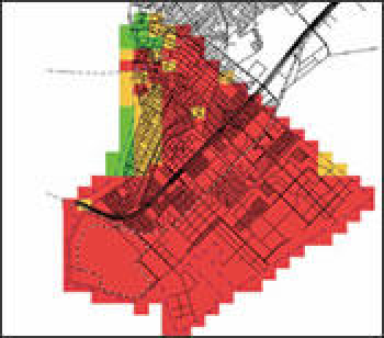
Conventional hazard map
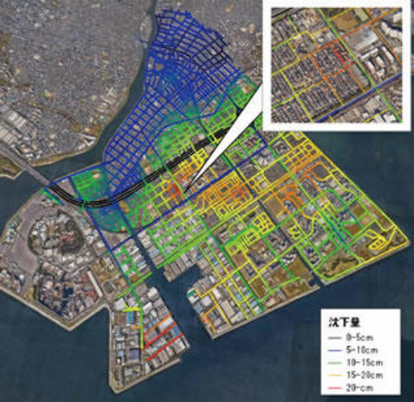
Road liquefaction hazard map
Source: Kiyota Laboratory at Institute of Industrial Science of University of Tokyo
Combining an array of social big data to proposing mobility assistance in event of large disasters
Mobility support is essential to safeguard lives in the event of disasters. It is thus necessary to prepare evacuation support contingency plans and monitor damage and road conditions immediately after disasters, providing information to residents and government bodies. Oriental Consultants is taking part in DOMINGO, a research project that combines and analyzes information on weather, traffic, social network sites, images, and other elements to develop tools to enhance safety and security in the event of disasters and streamline transportation after events. We developed a simulation model for evacuations by vehicles, walking, and trains to design and evaluate evacuation support measures in advance. By using this setup, we can simulate large area evacuations and project the effectiveness of evacuation measures. We developed a real-time disaster and traffic monitoring system. This system collects and processes a range of big data and makes it possible to quickly browse through information. This setup proved effective in providing information following the Kumamoto earthquake and in demonstration tests for road managers.
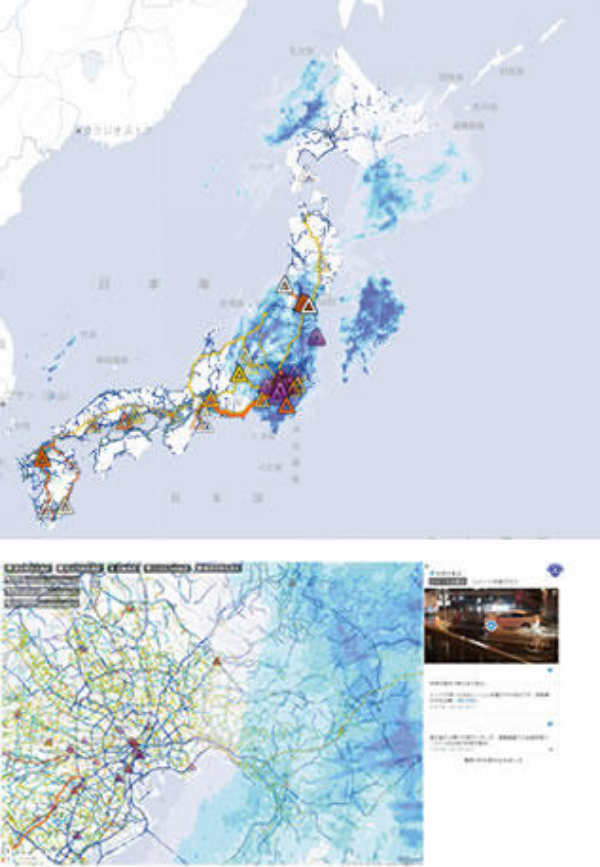
Our real-time monitoring and alert system can process and visualize data nationwide in the event of major disasters.
Incorporating frequency and severity of natural disasters in discussing disaster prevention measures that cater to an aging society needs and inbound tourists
In September 2017, Oriental Consultants held a symposium arranged by the Japan Emergency Management Association and sponsored by the Tokyo Metropolitan Government’s River Foundation in Shinjuku, Tokyo. The event focused on how Tokyo could formulate multifaceted disaster prevention measures in the years ahead. The greater frequency of natural disasters in recent years has necessitated more countermeasures, new challenges being the need to consider the needs of an aging population and a rise in inbound tourism. The symposium spotlighted the future, covering disaster prevention issues from multiple aspects and deepening knowledge about them. The first session explored four topics, including disaster prevention efforts that would factor in visitors to Japan. In the second session, Professor Itsuki Nakabayashi of Meiji University’s Graduate School of Political Science and Economics coordinated a lively discussion of how emergency measures should cater to the needs of foreign visitors, the elderly, and people with disabilities, and considered community issues.
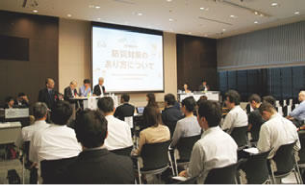
Participants exchanged views in a vibrant panel discussion.
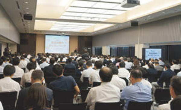
Enthusiastic participants in the event underscored tremendous interest in disaster prevention.

Upon the deployment of a new disaster prevention act, we received a request from the government to help improve disaster prevention capabilities through technological collaboration
Magnitude 8 earthquakes occur frequently in the west and southwest of Mongolia, although major damage has yet to be recorded. One of several faults is becoming more active in suburbs of the capital, Ulaanbaatar, which is home to around half of the population, increasing the risk of earthquakes. In February 2017, the national government enacted a new disaster prevention law that goes beyond the post-disaster emergency responses of the previous law. The act makes improving disaster prevention capabilities an urgent priority, focusing on disaster risk assessments, improvements in disaster prevention plans, and disaster prevention training and awareness. A project started at the behest of the national government. It factors in four priorities for action that the United Nations General Assembly endorsed under the Sendai Framework for Disaster Risk Reduction 2015 – 2030 after the Third UN World Conference on Disaster Risk Reduction in 2015. The project supports three themes, of legal frameworks and disaster prevention plans, earthquake-resistant structures, and disaster education. As head of a joint enterprise organization, Oriental Consultants Global put together an 18-member group of experts, and is collaborating with more than 50 counterparts. They include Mongolia’s National Emergency Agency, the Ministry of Construction and Urban Development, and relevant city officials.
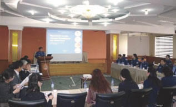
Working group members regularly convene Steering Committee gatherings to deepen discussions.
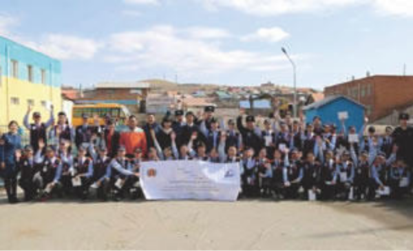
We provide technical cooperation support for school disaster prevention drills.
In view of international disaster prevention trends and current natural disaster situation, we undertook information gathering and confirmation studies to formulate strategies
The international community is increasingly focusing away from post-disaster emergency responses toward pursuing preparedness and the concept of Build Back Better to alleviate damage from natural disasters. Like Japan, the Philippines suffers from major natural catastrophes, and is achieving remarkable economic growth. As part of efforts to alleviate poverty, the nation is adopting policies that emphasizes risk management prior to disasters. Japan has collaborated extensively to realize this approach, building strong partnerships in the process. Under our project, we consulted with relevant organizations in exploring and identifying current issues in the disaster prevention sector and measures that should be prioritized in the years ahead. We reviewed collaborative strategies in 2008 in light of findings and undertook two steps. The first was to fully leverage disaster prevention cooperation efforts to date and the latest Japanese technologies and experience. The second was to formulate a new draft cooperation strategy that aligns Philippines government policies and socio-economic policy with a framework for cooperation in international and regional disaster prevention.
[Nepal]
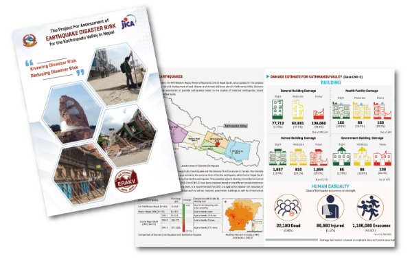
Supporting earthquake damage assumptions in Kathmandu Valley and helping to alleviate disaster risks, notably through regional disaster prevention plans.
An earthquake that struck Nepal in April 2015 killed around 9,000 people and flattened around 500,000 homes. Oriental Consultants Global conducted an earthquake hazard and risk assessment for the Kathmandu Valley in line of concerns that further quakes could hit the capital. Our findings contributed to regional disaster prevention plans among local government bodies in the area and to the implementation of disaster risk mitigation measures. We also prepared a regional disaster prevention planning manual for deploying initiatives nationwide, and are helping to reinforce Nepal’s disaster prevention structure.
We created and distributed information tools to build stakeholder awareness.
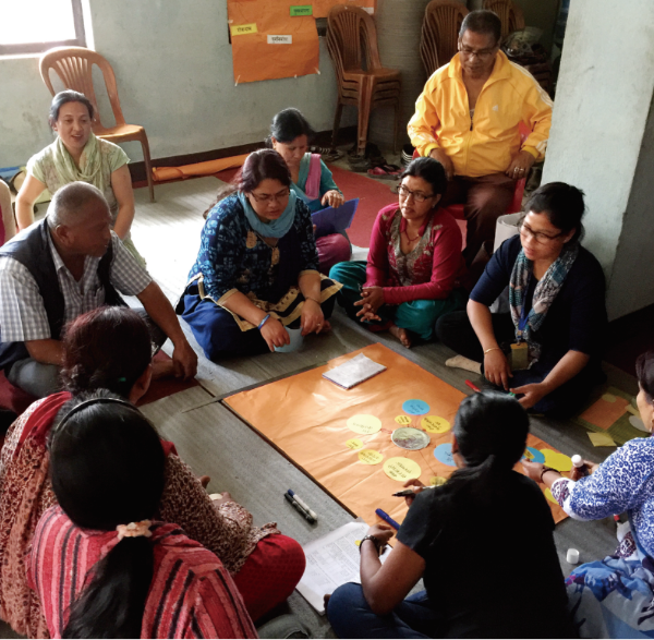
Local residents and community leaders gather for earnest discussions.
[Philippines]
Using hazard maps to encourage disaster-resistant urban development and livelihood recovery efforts while helping to rebuild public facilities.
Northern Leyte and Samar in the Philippines were devasted in Typhoon Haiyan of November 2013. For these areas, we drew on the lessons of disaster reconstruction in Japan to produce reconstruction plans that drew on maps for storm surges and other hazards and help local governments formulate land usage and disaster prevention plans. We also engaged in 22 subprojects to help restore livelihoods, notably through aquaculture and intercropping, and to rebuild schools, healthcare facilities, and other public infrastructure.
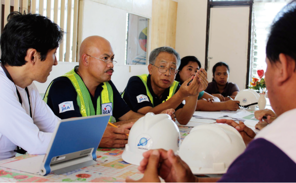
In reconstructing public facilities, we discussed disaster-resistant construction techniques.
A rebuilt vocational training facility.
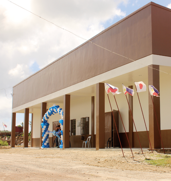
[Myanmar]
We built an early warning and disaster information system and conducted training to inform government officials and residents.
In May 2008, Cyclone Nargis wrought unprecedented damage in Myanmar, resulting in 138,000 dead and missing individuals. During the disaster, weather information was transmitted only from the central government to municipalities, and people did not get sufficient warnings, increasing the damage. Under this project, we set up model areas to ensure that disaster warnings swiftly and reliably reach residents. We also undertook wide-ranging initiatives to improve communication systems and monitoring and warning services while developing human resources and conducting drills.
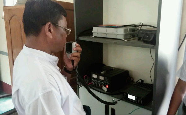
Training people to disseminate information over supplied radios.
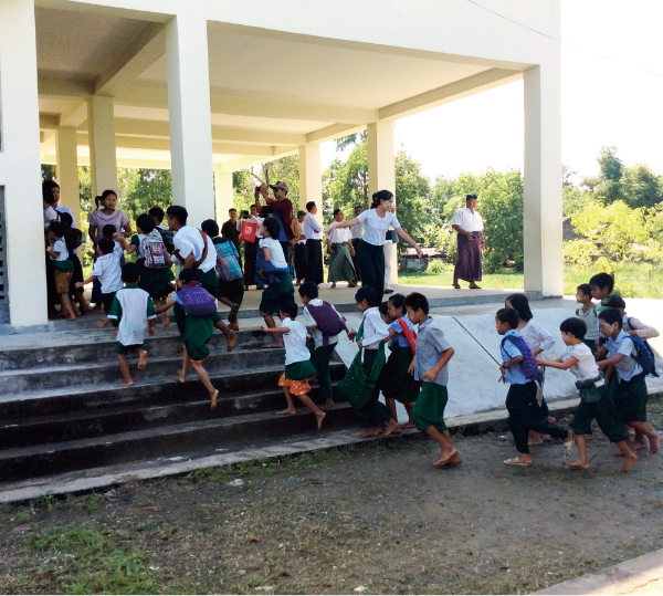
An elementary school constructed with Japanese aid also serves as a typhoon shelter, where we conducted evacuation drills.